")


June
Saturday
Uzunköprü - Uzunkopru - Узункьопрю - Ουζούν Κιοπρού
Uzunkopru, is the second largest population among the districts of Edirne after Kesan, and is a district that hosts the agricultural social structure of Thrace and has other similar characteristics. Uzunkopru is known by the same name as the bridge at the entrance of the city. The Ergene River has made a significant contribution to the historical development of the city. The city, which was established on the riverside during the Ottoman period, followed a development process parallel to what the river added to agriculture and the city.
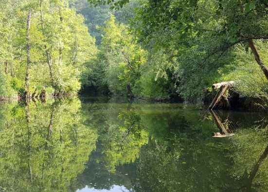
The most important problem in Uzunkopru is the pollution of Ergene. The pollution in the river, which originates from the Yildiz Mountains, cuts horizontally through Thrace, merges with the Meric River and flows into the Aegean Sea; negatively affects the agricultural production, economic activities and therefore the social life in the district. Preventing pollution and reducing the damage caused by pollution will make a great contribution to increasing the economic and social vitality in the settlements around the Ergene River.
Uzunkopru is located in the middle of Lalapasa, Suloglu and Meric districts and is the most preferred center by the people in these districts after Edirne. Having the third largest population after Edirne Center and Kesan and the economic vitality it hosts are the most important indicators of this situation.
Uzunkopru is a district of Edirne Province in the Thrace region of the Marmara Region. It is bordered by Edirne Central and Havsa districts to the north, Pehlivanköy and Hayrabolu districts to the northeast, Malkara and Kesan districts to the south, Meric district to the southwest, and Greece to the northwest. The central district has an elevation of 18 m above sea level, with Suleymaniye Hill at its highest point at 378 m. The Ergene Plain constitutes the district's most important agricultural area. The district has fertile soil. Grain, sunflowers, sugar beets, melons, watermelons, grapes, onions, and garlic are important agricultural products.
Livestock farming and sheep farming are important. Dairies are famous for their full-fat cheeses.
A large portion of Turkiye's sunflower oil, flour, and rice needs are met. Trade activity is primarily focused on the domestic market. The district's Chamber of Commerce is one of Turkiye's oldest.
An industry has developed primarily based on agriculture.
The district of Uzunkopru, named after the world's longest stone bridge, bears traces of a five-century-old history. In Uzunkopru, you'll find the opportunity to experience the mystique of the harmonious union of historical richness and contemporary life.
Uzunkopru
|
Uzunkopru District Governorate
|
Uzunkopru Municipality
|
| Area | 1.185 km² |
| Altitude | 35 m |
| Population 2025 | 59.085 |
| Telephone Area Code | 284 |
| License Plate Code | 22 |
| Postal Code | 22200 - 22260 - 22270 - 22300 - 22360 - 22402 |
| Uzunkopru District Governor | Muammer Koken |
| Mayor of Uzunkopru | Ediz Martin |
| Update | |
| View | 4.004 |
Uzunkopru Statistics
Detailed statistical data of the Uzunkopru region are available on our pages.

Uzunkopru Population Information
Province, district, town, neighborhood, and village population information

Uzunkopru Migration Information
Immigration information received and given by Thracian settlements

Uzunkopru Economic Information
Detailed statistics on the livelihoods of the Thracian people

Uzunkopru Tourism Information
Tourism data of the Uzunkopru region

Uzunkopru Health Information
Health personnel statistics with birth and death information in Uzunkopru

Uzunkopru Election Results
Results of the Turkish parliamentary general elections

Other Uzunkopru Statistics
Other statistics related to the Uzunkopru region
Uzunkopru Topics

History
History of Uzunkopru

Geography
Geography of Uzunkopru

Education
Uzunkopru educational institutions

Administrative Status
Uzunkopru administrative administrations

Economy
Uzunkopru economy

Health
Uzunkopru health institutions

Transport
Uzunkopru transportation information

Press
Uzunkopru press organizations

Sport
Uzunkopru sports infrastructure and clubs

Celebrities
Celebrities born in Uzunkopru
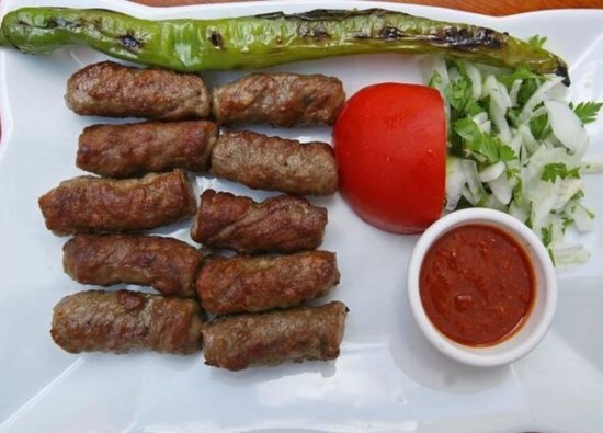
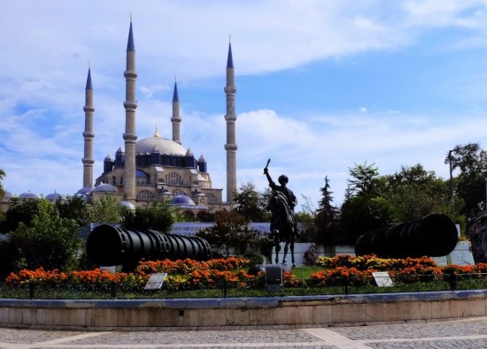
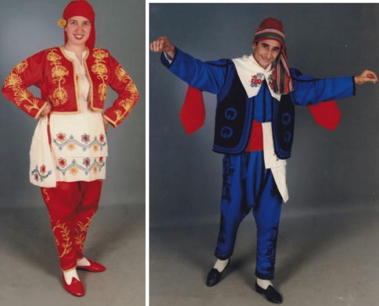
Uzunkopru Tourism Information
Updating
Data entry on our pages is ongoing and will be published as soon as possible.
Updating
Data entry on our pages is ongoing and will be published as soon as possible.
Updating
Data entry on our pages is ongoing and will be published as soon as possible.
Updating
Data entry on our pages is ongoing and will be published as soon as possible.
Uzunkopru Photos

Uzunkopru Transportation
Alıc -
Altinyazi -
Aslihan -
Balaban -
Balabankoru -
Basagil -
Bayramli -
Beykonak -
Bildir -
Cakmak -
Cali -
Cavuslu -
Ciftlik -
Cobanpinar -
Danisment -
Degirmenci -
Derekoey -
Elmali -
Eskikoy -
Gazimehmet -
Gemici -
Hamidiye -
Hamitli -
Harmanli -
Hasanpinar -
Kadikoy -
Karaburcek -
Karapinar -
Karayayla -
Kavacik -
Kavakazma -
Kirkkavak -
Kirkoy -
Kiremitcisalih -
Kurdu -
Kurtbey -
Kurttepe -
Maksutlu -
Malkoc -
Meseli -
Muhacirkadi -
Omerbey -
Saclimusellim -
Salarli -
Sazlimalkoc -
Sigircilik -
Sipahi -
Sultansah -
Suleymaniye -
Turnaci -
Turkobasi -
Yagmurca -
Gazihalil